


NASA has successfully tested lidar technology that will be used to land spacecraft on the Moon and Mars during a series of flights from the Armstrong Flight Research Center in Edwards, California last month.
The Psionic Space Navigation Doppler Lidar (PSNDL) system uses lidar and Doppler shifts of light reflected from the ground to measure distance , enabling real-time, highly accurate velocity and altitude measurements.
The technology was originally developed by NASA researchers and was licensed to Psionic in 2016 to commercialize.
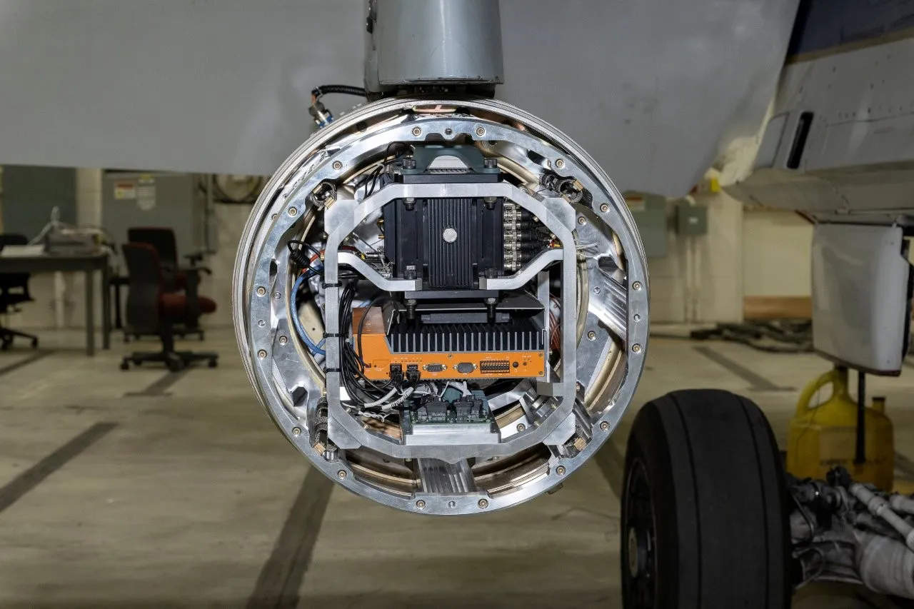
Psionic has miniaturized the system, added further functionality, and incorporated component redundancies to make it suitable for spaceflight. The PSNDL system also includes cameras and an inertial measurement unit to make it capable of accurately determining a vehicle’s position and velocity for precision landing and other spaceflight applications, such as docking.
According to Psionic the tests represent a significant step forward in high-precision navigation, for space, aviation, defense and commercial applications. PSNDL can also be used for navigation in GPS-denied or contested environments.
In space, lidar-based sensors will be crucial for landing in sunlight-challenged areas such as the south polar regions of the Moon, as well on Mars.
William Cook, senior vice president of space operations at Psionic said, “The performance of the PSNDL system during our F-18 flight tests is a major milestone for Psionic. This success underscores the transformative potential of lidar-based navigation systems, enhancing accuracy and reliability for spacecraft, aircraft, and ground vehicles – key factors for commercial applications.”
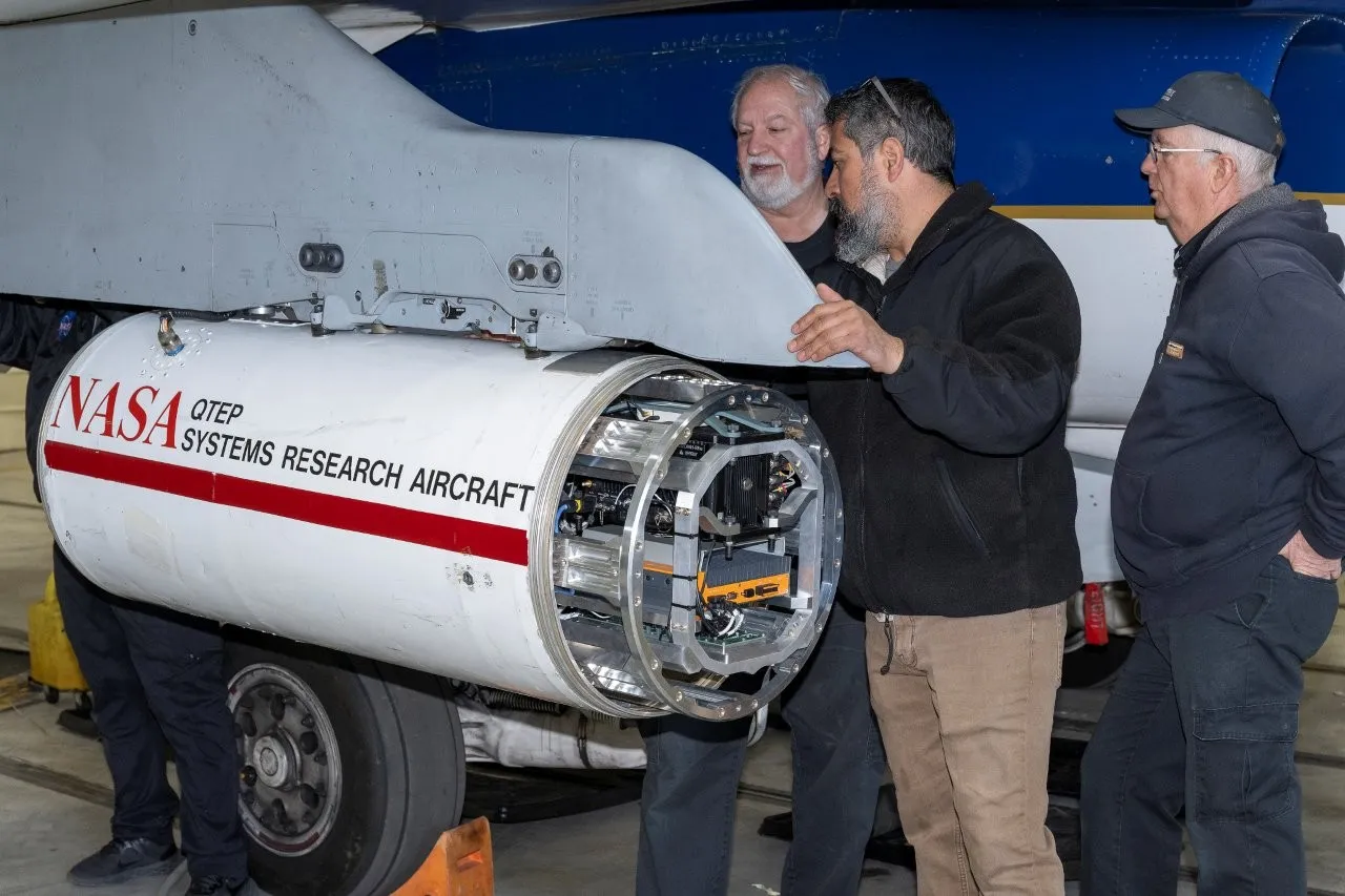
For the flight test campaign, the PSNDL system was housed in a refurbished instrument pod beneath the NASA F-18 fighter jet’s wing. Over several days the system’s capability to improve navigation precision was tested across different flight conditions, including altitudes of up to 30,000 feet and speeds approaching Mach 1.
The F-18 also flew a large figure-8 loop and conducted several highly dynamic maneuvers over Death Valley, California, to collect navigation data at various altitudes, velocities, and orientations relevant for lunar and Mars entry and descent.
The original NASA-developed Navigation Doppler Lidar technology was demonstrated in space with some success during a commercial lunar mission last year.
Pairing PSNDL with cameras adds the ability to visually compare pictures with surface reconnaissance maps of rocky terrain and navigate to landing at interesting locations. Data is processed by a computer to make quick, real-time decisions to enable precise touchdowns at safe locations.


