Seattle, USA-based provider of aerospace testing, engineering, and certification services, AeroTEC, has completed two proof-of-concept drone surveys at airports in Washington state.
The aerial surveys, in collaboration with the Washington State Department of Transportation (WSDOT) Aviation Division, took place at Sunnyside Municipal Airport and Prosser Airport.
Designed to assess the use of photogrammetry to evaluate runway obstacles, this was the first time the technique had been used for WSDOT Aviation’s 5010 airport inspections.
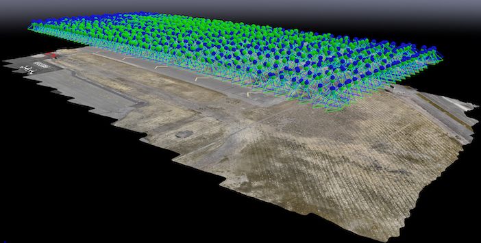
AeroTEC’s Part 107 pilots flew a drone to capture a series of images which were then used to create virtual models of the airports. The models were then analyzed and used to identify obstacles in a predetermined area near the end of each runway as required by the Federal Aviation Regulations.
By using the drone-enabled photogrammetry technology, AeroTEC was able to provide WSDOT with a runway obstacle report with a far higher degree of accuracy and lower cost than traditional methods.
“The successful completion of these aerial photogrammetry surveys means we have found a significant cost-saving opportunity for the taxpayers of Washington state,” said David Fleckenstein, director of WSDOT Aviation Division. “Using drones to map airports and provide precision data in regard to obstructions around airports is just one of the many uses we envision. This is a great first step in leveraging the technology to perform tasks that traditionally took a lot of time and effort.”
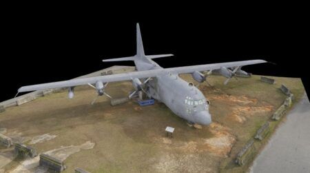
AeroTEC is expanding its drone capabilities and is in the process of establishing a UAS test range in Washington state for testing all aspects of drones. It is also developing new applications for this technology such as in-hangar aircraft inspections, 3D aircraft rendering and external aircraft inspections.
